U.S. Route 6 – From Wellsboro to Warren – to The Wonders of the Wilds!
From the Pine Creek Valley & PA Grand Canyon, and Dark Skies, to the Allegheny National Forest & Surrounds landscapes, Route 6 is something straight out of a Norman Rockwell painting and a throw-back to a much slower pace of life.
It is also time-travel at its finest, passing through idyllic little villages, farm communities and beautiful boroughs, where the scenery has barely changed over the years.
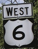
This is the main artery leading to “The Nine Wonders of the Wilds”: The Pennsylvania Grand Canyon, the Triple Continental Divide, the Ice Mine, Cherry Springs Dark Skies, Austin Dam Ruins, Kinzua Skywalk, Hearts Content, Kinzua Dam, and Cook Forest.
This route, where wolves and panthers once abundantly roamed, is the Commonwealth’s last truly wild place. The earliest stretch of road was cut from Native American pathways and old wagon trails.
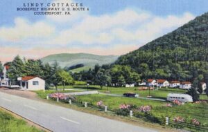
Having traveled Route 6 through the Pennsylvania Wilds countless times over the past 50 years, I understand why National Geographic Magazine chose it as “one of the most scenic drives in the United States.” The Weather Channel selected it as its Pennsylvania choice for “Amazing Road Trips to Take in Every State,” and Route 6 was chosen by Harley Davidson as Pennsylvania’s Best Touring Route and named as one of the top scenic routes in the nation by Car & Driver Magazine.
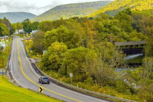
Running across the United States, Pennsylvania’s 400 mile stretch of Route 6 became part of a national highway system, running more than 3,000 miles from Provincetown, Massachusetts to Bishop, California.
The early formation of Pennsylvania’s Route 6 began in 1807 when state officials in Harrisburg approved funding for construction of a road to connect the northern-tier county seats of Wellsboro, Coudersport, Smethport and Warren.
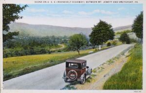
As the state and nation grew, so did Pennsylvania’s Route 6. The highway connected lumber and oil towns in the north to railroads and industry to the south and east.
This highway is known by several names. Before it officially received the numerical “6” designation, it was known as “The Roosevelt Highway” by order of Pennsylvania Governor Gifford Pinchot in 1919 to honor his good friend and confidant President Teddy Roosevelt who had died that year.
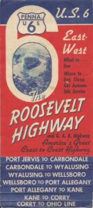
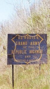
Then in 1937, the Sons of the Union Veterans of the Civil War wanted the highway named in honor of their brothers-in-arms, living and dead. So, in 1948, the Pennsylvania legislature recognized Route 6 as both “The Roosevelt Highway” and “The Grand Army of the Republic Highway” (GAR).
Most travel writers agree that no other 200-mile segment of Route 6 anywhere across the United States is more scenic than ours with so much to see and offer tourists. Admittedly, we sometimes take this for granted.
A few years ago, a New York City travel writer told me he was going to take in all nine wonders of the wilds from Wellsboro to Warren and thought he could do it in a single day. Nice try. He made it as far as Coudersport by evening and had to finish his journey the next day.
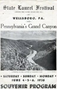
The trek began in Wellsboro. With its authentic gas streetlights through the middle of town, Wellsboro is known as “The Town that Saved Christmas.” Just 15 minutes down Route 6 is the Pennsylvania Grand Canyon, which features two beautiful state parks, Leonard Harrison and Colton Point, on opposite Canyon rims. The Canyon also hosts the annual Pennsylvania State Laurel Festival.
The Borax Company’s 20-mule-team traveled this stretch of Route 6 in the 1920’s and it was one of the routes used by the Bicentennial Wagon during its 1976 trek to Valley Forge.
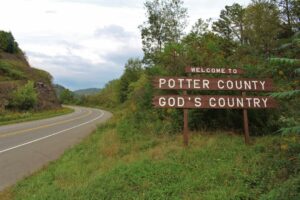
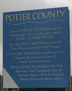
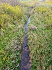
Potter County, widely known as “God’s Country, is a popular tourist destination. Just off Route 6 past Galeton and up route 449 to route 49, lies the only Triple Continental Divide east of the Mississippi. This is “headwaters mountain,” where the Allegheny, Genesee and Susquehanna Rivers begin. A raindrop falling on this mountain can go in any one of three directions, to the Mississippi (via the Allegheny), the Great Lakes (via the Genesee) or into the Atlantic Ocean (via Pine Creek and the Susquehanna) and on to Chesapeake Bay.
Just down the road, there is the nationally renowned Pennsylvania Lumber Museum and right across the street, Denton Hill State Park. Here, we are at the highest elevation along the entire stretch of Route 6 across the Commonwealth. This area is known as the “Big Fill” because thousands of tons of dirt were trucked-in to level the road across a valley.
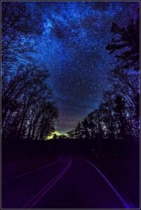
Heading into Sweden Valley, just south of Route 6, is State Route 44, known as the “Highway of the Stars.” It takes you to Cherry Springs State Park, where stargazers flock to watch the heavens under the darkest sky east of the Mississippi.
Just up the road off Route 6 is Ice Mine Road which leads to one of nature’s true phenomena, the Coudersport Ice Mine, with a deep shaft of ice that strangely melts in winter and freezes again in summer. At the height of its popularity back in the early 20th century, shuttle buses ferried tourists from their parked cars along Route 6 up to the Ice Mine tucked away in a mountain side.
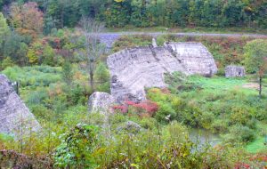
A few miles down Route 6, Route 872 goes south to the ancient ruins of the Austin Dam, which collapsed in 1911, killing 78 people and nearly wiping the town of Austin off the map. Every August the disaster is commemorated and celebrated with a music and art festival.
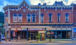
Route 6 then takes us on to Coudersport and the only town in the Wilds where Route 6 crosses the Allegheny River three times. Here, they pay tribute to their most famous son, nationally renowned crime-fighter Eliot Ness, who retired to Coudersport in the mid-1950s and died there. A museum dedicated to Ness, who later became the inspiration for the TV and motion picture “The Untouchables,” is housed in the middle of town and celebrated with an annual festival in July.
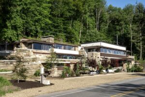
Rising up into the Seneca Highlands further down Route 6 west of Port Allegany sits the majestic “Lynn Hall,” dubbed Fallingwater in the PA Wilds. Lynn Hall master builder and Port Allegany native son, Walter J. Hall, served as Frank Lloyd Wright’s chief contractor for the world famous Fallingwater. The similarities between these two stunning examples of modernistic architectures are striking.
Heading west toward Smethport, this roller-coaster stretch of Route 6 has “the big level,” second only to Denton Hill as the highest elevation along Route 6.
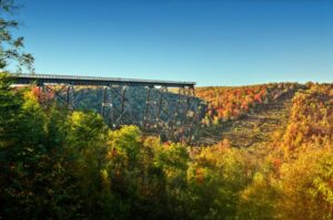
Just down the road you can “walk across the sky” on what was once billed as the tallest railroad bridge in the world. Mt. Jewett’s Kinzua Bridge Skywalk rises 300 feet high above the Kinzua Valley floor, with breathtaking views. The Kinzua Bridge State Park features an elaborate visitors center with interactive exhibits and a PA Wilds gift shop.
Next is the borough of Kane, where a youthful mayor and her busy, dedicated team are doing a remarkable job of revitalizing the town. Taking Route 6 south from Kane, Cook Forest is 40 minutes away. Known as a land of giants because of the “forest cathedral” of ancient pines and hemlocks, Cook Forest is home to many of the tallest hemlock and pine trees in the Northeast.
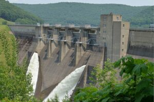
Continuing westbound on Route 6, we enter the Allegheny National Forest. Passing through Sheffield and heading west toward Warren lies the beautiful 25-mile-long Kinzua-Allegheny Reservoir where the Kinzua Dam is an impressive site.
Completed in 1965 at a cost of $120,000,000, it is the largest concrete and earth-fill dam in the eastern United States. Nearly 1,900 feet long and 179 feet high, it was built to control flooding along the Allegheny River from Warren all the way down to Pittsburgh. It is estimated the dam has prevented an estimated $1 billion in downstream flood damage since it became operational in 1965.
The borough of Warren is the most populous town in the northern tier of the Pennsylvania Wilds. Here is where lumber and oil money built stately homes, many of which have been meticulously maintained to this day.
Just west of Warren, there is a miniature replica of the famous St. Louis Gateway Arch out in front of the Warren County Visitor Center.
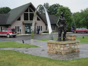
The mini-arch is a tribute to the 280 workers at Warren’s Pittsburgh Des Moines Steel Company who designed and built 80 percent of the 630-foot-high St. Louis arch in 1965 and, piece-by-piece, shipped it by rail from Warren to St. Louis for assembly.
Through Youngsville we exit Warren County and leave the Route 6 stretch of the Wilds.
We’ve talked about the various names of Route 6 through the years: The Roosevelt Highway, the Grand Army of the Republic Highway, but how about one more? Today, it is also known as the “PA Route 6 Heritage Corridor” and is managed by the PA Route 6 Alliance.
This Alliance began in 2003 to promote tourism and foster ways to build more sustainable local economies to enhance the quality of life in every community along Pennsylvania Route 6.
Those green mile marker signs you see along the route were placed there by the PA 6 Alliance.
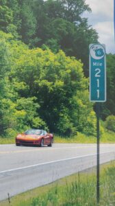
Across the PA Wilds you’ll see them from mile marker 234 in Mansfield eastbound, to mile marker 67 exiting westbound from Warren County. These markers help visitors find businesses and artists on the Route 6 Artisan Trail.
The PA Route 6 Artisan Trail was created in 2004 with the goal of raising awareness of the arts and creative industry of the Route 6 Heritage Corridor. The trail now boasts a network of 400+ northern Pennsylvania artisans, creative businesses, cultural organizations, tourism businesses, and arts supporters. Encouraging the success of these artisans and arts organizations has proven to enhance the economy, culture, and quality of life across the region.
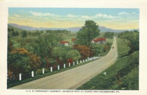
Approximately 3.5 million people travel this beautiful highway through the Pennsylvania Wilds each year to visit the Wonders of the Wilds, historic sites, national and state parks, artists’ studios, and quaint little towns, all of which are vintage northern Pennsylvania and true Americana.


