E-Scouting Mountain Bucks in the PA Wilds
By Toren Shirk
Understanding how Mountain Bucks use terrain to pick bedding locations and ultimately specific beds is an integral part to early season success in the big timber of the PA Wilds. This article is going to break down how I go about e-scouting hunting locations based upon terrain, thermals and predominant winds to predict buck bedding locations. If you’re unfamiliar with e-scouting it is simply using tools like onX Hunt or Google Earth, utilities that have some form of mapping software to predict deer movement from your computer or smartphone.
Let’s start out with a generic description of what the terrain looks like that we will be focusing on for e-scouting. The PA Wilds has a large diversity of habitat but for the sake of this article we are going to focus on mountain chains that primarily peak around 2,000 to 2,500 feet and have multiple drainages feeding large streams or rivers.
The primary key to locating these beds and or bedding areas is understanding thermals. We could do an entire blog on thermals but let’s just go over the quick and dirty. Thermals are the upward current of warm air. This is what you will see turkey vultures gliding across mountains on when you are in your stand. However thermals can be tricky in that they aren’t always rising. A standard rule of thumb is that thermals rise in the morning and fall in the evening. So let’s imagine that we are a Big PA Mountain Buck trying to avoid predators. How can I best use those thermals in my favor to protect myself? The answer is thermal points!

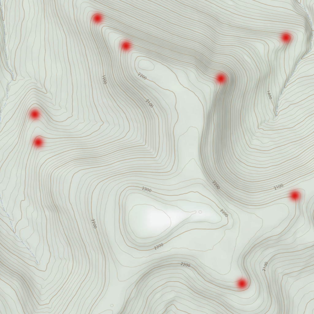
Thermal Points are areas during the day that the warm air is being blown up the mountain to a point that allows the buck to be able to smell everything below him on the hillside or even all the way to the valley floor (red dots represent points and potential buck bedding). Now you may be wondering how do I pin down exactly where these thermal points are and correlate them to buck beds, the northern mountains are covered in points.

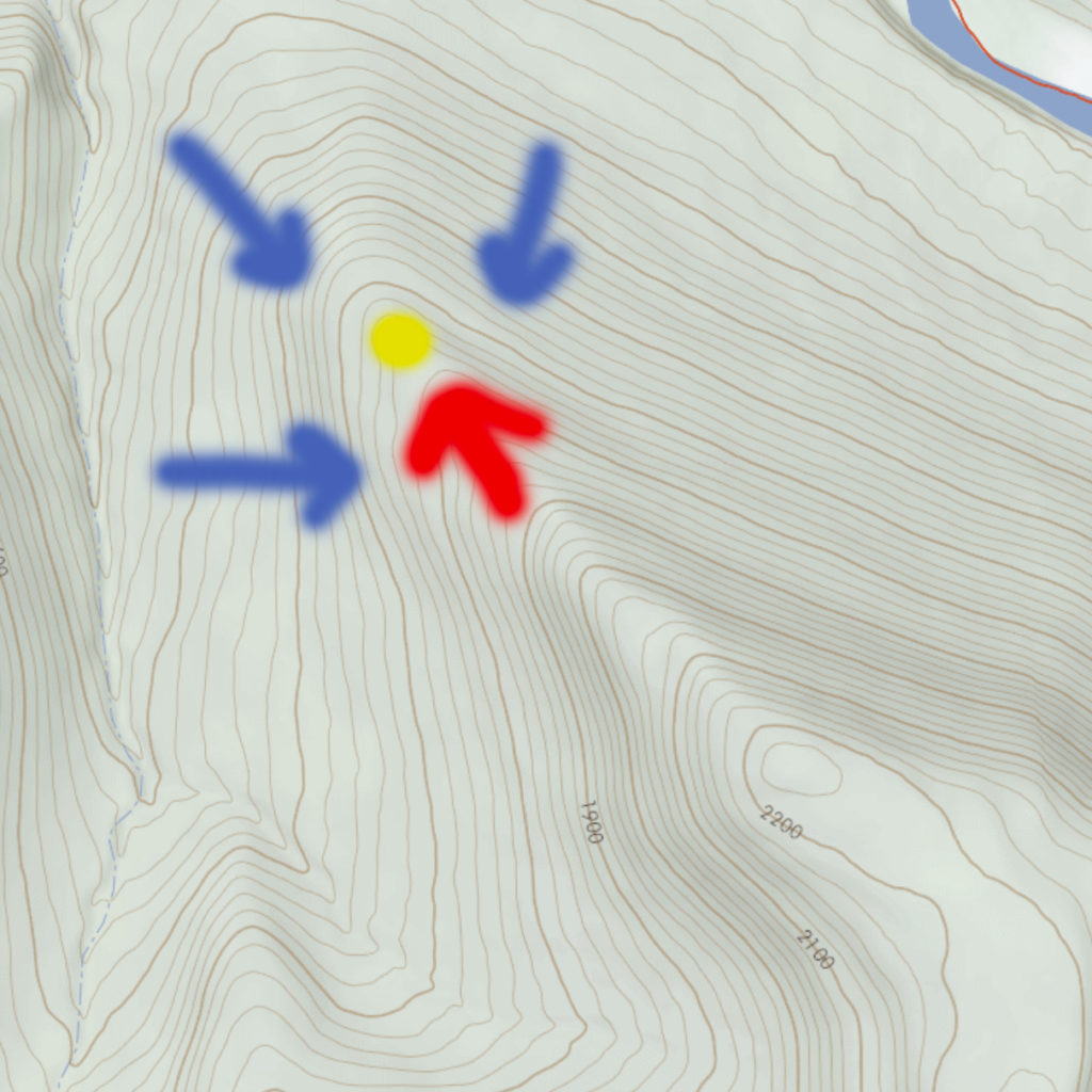
While that is correct, however there are only a few points on a mountain that allow a buck to bed on the edge of these points and look out across a flat guarding his entrance and exit into that bed. Now here is the most important factor on whether that buck will be using that bed or not. The predominant wind that day will determine whether that buck uses that bed or not. So for example, let’s say you have a thermal point going to the North. That location is a great bedding location for a South, South East and South West wind. What the buck will do will face his back into the head wind, i.e. southern direction and look down over the point to the valley floor. This will allow the buck to be able to smell anything to his back while also being able to smell and see anything below the point to the North.

In this video, you can see how I specifically break down points using onX and predict how bucks will use them based on thermals and wind direction.
About the Author
Toren Shirk began hunting at the age of 12 in the Pennsylvania forests. Mentored by his grandfather, Toren was instilled with the values of the great outdoors which inspired him to get a degree in Wildlife Biology. He now works as the Social Media and Field Staff Manager at Cervicide. In Toren’s words, “Hunting to me is more about being able to match wits with nature and the creatures that live with her. As cliche as it sounds, the thrill of the hunt, the chase is what really drives me.”


